Megamenu

Satellite Communication

Satellite Communication

SSDMA has made notable advancements in communication systems to ensure uninterrupted connectivity during disasters.

  • Deployment of Satellite Phones: A total of 8 satellite phones have been deployed across the state.
  • Each district has been equipped with a satellite phone.
  • Additional satellite phones are available at SSDMA Headquarters and Chungthang.
  • Ensures communication continuity during network failures.
  • Supports coordination of relief operations and information dissemination.
List of Satellite Phones under SSDMA
Sl. No District / Location Phone No
1SSDMA-HQ8991118855
2Namchi District8991118856
3Mangan District8991118857
4Pakyong District8991115520
5Gangtok District8991125527
6Soreng District8991125529
7Gyalshing District8991125528
8Chungthang SDM (Mangan District)8991125530

Extension of Emergency Response Support System (ERSS) 112

ERSS 112 Emergency Response

The Emergency Response Support System (ERSS), a flagship national initiative for integrated emergency services, has been extended in Sikkim to incorporate disaster management functionalities. This integration has significantly strengthened the state’s capacity to respond to emergencies in a coordinated and efficient manner.

Key Features of ERSS 112
  • 24x7 Helpline (112): A dedicated emergency number for all disaster-related emergencies.
  • Trained Personnel: Control center staff handle distress calls and ensure quick response.
  • Inter-Agency Coordination: Integration with Police, Fire, Health, and Disaster Management teams.
  • Real-Time Monitoring: Use of modern ICT tools for tracking and response management.
  • Quick Routing: Calls are directed to the appropriate agency with minimal delay.
Benefits
  • Single point of contact for citizens in distress.
  • Faster emergency response and reduced reaction time.
  • Improved coordination among departments.
  • Enhanced disaster preparedness and management.
  • Reduction in impact of disasters through timely intervention.

By integrating ERSS 112 into disaster management operations, Sikkim has significantly streamlined its emergency response mechanism, ensuring timely assistance and improved coordination across agencies.

Rainfall-Induced Landslide Early Warning System

Landslide Early Warning System

The State Disaster Management Authority (SSDMA) has collaborated with the Geological Survey of India (GSI) to develop a state-wide Rainfall-Induced Landslide Early Warning System. This initiative aims to predict landslides triggered by heavy rainfall, which is a common occurrence during the monsoon season in the region.

System Components
  • Collection and analysis of meteorological and geological data.
  • Preparation of landslide susceptibility maps identifying vulnerable areas.
  • Issuance of landslide forecasts and warnings by the Central Water Commission (CWC).
  • Experimental bulletins are now operational specifically for Sikkim.
Key Benefits
  • Provides advance warning to communities.
  • Helps reduce loss of life and property damage.
  • Supports proactive disaster preparedness.
  • Enhances decision-making for authorities.

This system acts as a critical tool for minimizing the impact of landslides by enabling timely alerts and strengthening disaster response mechanisms across the state.

Pilot Project for Landslide Mitigation at Mangan (SNT Site)

Landslide Mitigation Mangan

To address recurring landslide issues at the SNT site in Mangan town, the district headquarters of North Sikkim, SSDMA has initiated a pilot project for landslide mitigation with support from the National Disaster Management Authority (NDMA).

Technical Approach
  • Piles and Self-Drilling Anchors: Structural reinforcements to stabilize slopes and prevent further movement.
  • Shotcreting: Application of shotcrete for slope surface protection and enhanced stability.
  • Drainage Solutions: Effective drainage systems to control water flow and reduce soil erosion.
Project Impact
  • Controls mass movement of slopes.
  • Enhances safety of infrastructure and residents.
  • Provides long-term landslide mitigation solution.
  • Strengthens disaster resilience in Mangan region.
Future Scope

Further proposals are under consideration to undertake additional stabilization work at the base of the landslide, ensuring a more comprehensive and long-term solution.

Common Alert Protocol (CAP) – SACHET System

CAP Sachet Alert System
SACHET Mobile App

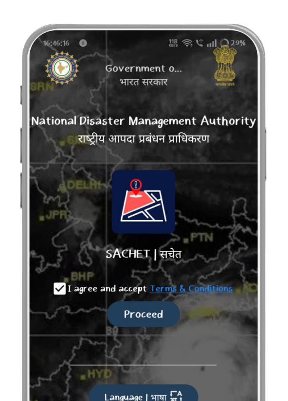
The State Disaster Management Authority (SSDMA) has successfully implemented the Common Alert Protocol (CAP) based “SACHET” system, a state-wide initiative aimed at disseminating SMS-based alerts and warnings to the public. This system plays a vital role in ensuring timely and effective communication of potential disaster threats.

Key Features
  • Automated dissemination of alerts via SMS to residents in affected areas.
  • Integration with national and regional alerting systems for consistent messaging.
  • Real-time updates regarding hazards and safety measures.
  • Enhanced reach through Cell Broadcast-Based Alerting.
Benefits
  • Immediate warning to citizens during emergencies.
  • Helps reduce risk and improve response time.
  • Ensures wider coverage even without mobile number dependency.
  • Strengthens disaster preparedness across the state.
SACHET Mobile Application

The SACHET mobile application is available on both Android and iOS platforms. Citizens are encouraged to download and install the application to receive real-time alerts, warnings, and important disaster-related information.

Installation of Automated Weather Stations (AWS) for GLOF Monitoring

Automatic Weather Station GLOF Monitoring

In collaboration with the Swiss Development Cooperation (SDC) and the National Disaster Management Authority (NDMA), SSDMA has initiated the installation of Automatic Weather Stations (AWS) at critical glacial lakes in North Sikkim. These installations are vital for monitoring climatic and hydrological parameters to predict and mitigate the risk of Glacial Lake Outburst Floods (GLOF).

Locations
  • South Lhonak Glacial Lake, North Sikkim
  • Sako Chu Glacial Lake, North Sikkim
Functionality
  • Continuous monitoring of temperature, precipitation, and water levels.
  • Real-time transmission of data to a central monitoring system.
  • Integration with Early Warning Systems (EWS) for timely alerts.
Key Benefits
  • Early detection of potential GLOF risks.
  • Improved preparedness for downstream communities.
  • Data-driven decision making for disaster management.
  • Enhanced monitoring of environmental and climatic changes.

These initiatives provide critical insights into the environmental dynamics of glacial lakes, enabling proactive disaster management and strengthening resilience against GLOF-related hazards.

Real-Time Landslide Early Warning System – Chandmari, Gangtok

CAP Sachet Alert System
SACHET Mobile App

In partnership with Amrita Vishwa Vidyapeetham, SSDMA has implemented a real-time Landslide Early Warning System at Chandmari in Gangtok, East Sikkim. This advanced system is designed to predict landslides with significant lead time, enabling efficient evacuation and disaster response.

Technical Specifications
  • Installation of sensors to monitor ground movement, moisture, and other critical parameters.
  • Data processing at the Field Management Center (FMC) in Chandmari.
  • Data transmission to the Data Management Center (DMC) at Amrita University, Kerala for detailed analysis.
  • Identification of threshold conditions for landslide prediction.
Operational Benefits
  • Provides up to 24-hour advance warning of potential landslides.
  • Enables timely evacuation and mitigation measures.
  • Enhances safety of residents and infrastructure.
  • Improves disaster preparedness and response coordination.

This system demonstrates the effective use of advanced technology in disaster management, offering a reliable framework for early warnings and preventive action against landslides.

Mock Exercise for Disaster Preparedness

Mock Disaster Exercise

A Mock Exercise is a practical method to simulate real-time emergency situations, enabling stakeholders and communities to understand how to respond effectively during disasters. It provides hands-on experience in evacuation procedures, use of emergency systems, hazard awareness, and adherence to safety protocols.

Such exercises help build a culture of preparedness, test existing plans and Standard Operating Procedures (SOPs), assess the readiness of departments, identify gaps, and improve coordination and resource utilization.

Objectives of the Exercise
  • Test and review SOPs of line departments.
  • Define roles and responsibilities of stakeholders.
  • Enhance coordination among State and District agencies.
  • Increase public awareness through involvement of local bodies, NGOs, and citizens.
Steps for Conducting the Exercise
  1. Incident Response System (IRS): Training to clarify roles and establish structured response mechanisms.
  2. Orientation-cum-Coordination Conference: Finalization of objectives, scope, participants, and logistics.
  3. Table Top Exercise (TTEx): Simulation-based discussions to evaluate preparedness and identify gaps.
  4. Mock Exercise: Full-scale drill involving all stakeholders to test real-time response.

Mock exercises are essential for strengthening disaster preparedness, improving coordination, and ensuring effective response during real emergency situations.